Wetland selfies: Chronolog project promotes citizen science

Participating in citizen science is as easy as snapping a photo on your smartphone.
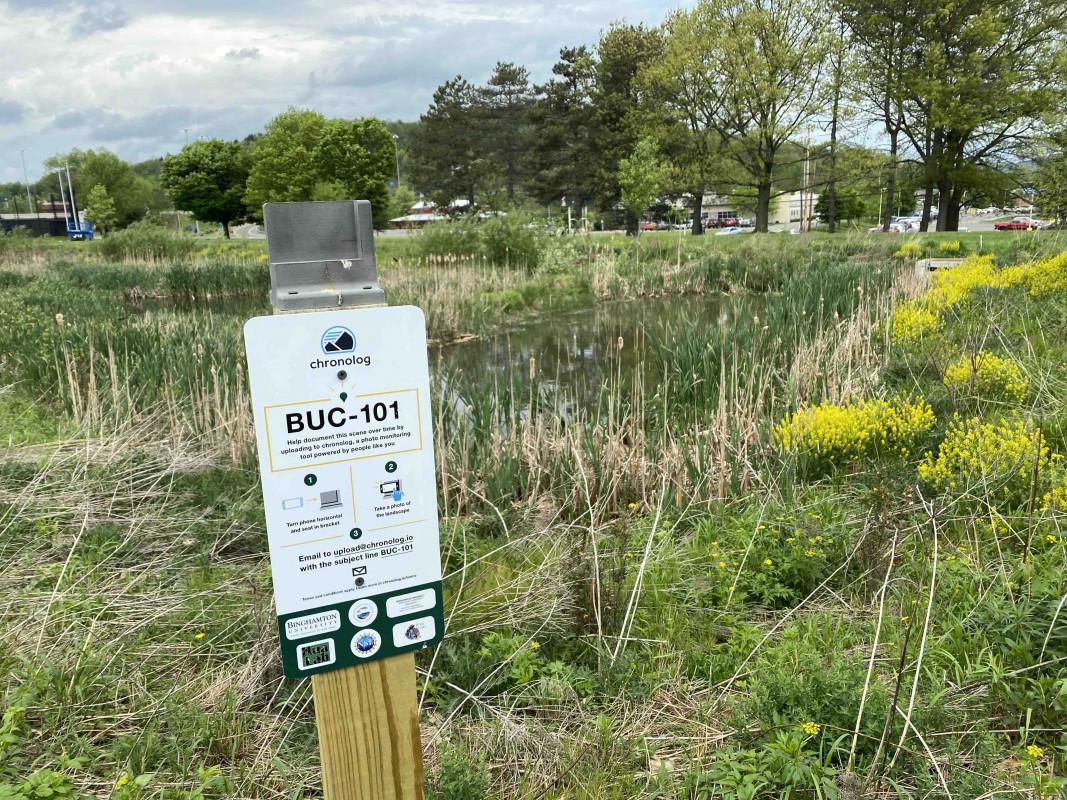
This spring, Binghamton University unveiled six Chronolog stations throughout campus. Participants use their smartphone to take a picture and upload it to the Chronolog site, which creates a timelapse compilation of the photos. The goal is to use public participation to observe seasonal changes in ecosystem processes.
“In reality, there are probably ways you can collect data more efficiently. But then there’s the community engagement side of things, and that’s where the Chronologs are really useful: getting people to go out there and see sites they wouldn’t normally see or learn more about the places they walk past every day,” said Jon Schmitkons, a research assistant professor in the First-Year Research Immersion (FRI) program’s biogeochemistry stream who manages the campus’ Chronolog network.
The seeds for the project were sown in 2019, with a campus field trip Professor of Geological Sciences and Environmental Studies Joseph Graney led for a Watershed Forum hosted by the Center for Integrated Watershed Studies. That experience ultimately became the virtual campus field trip the center developed in 2021; the Chronologs were added in spring 2022.
The stations are located at the following sites:
- The Bartle Constructed Wetlands complex, at the edge of the wetlands next to the parking lot
- The constructed wetlands at Lake Lieberman, located near the disc golf course’s 11th tee
- The new deer enclosures in the Nature Preserve, located along the Connector Trail
- The Beaver Dam Wetlands complex in the Nature Preserve, located along the wooden walkway near the main pond
- The newly constructed check dam in Nuthatch Hollow, located next to the boardwalk on the east side of the pond
- The Three Sisters Garden in the Science 1 courtyard
“The idea is you get people that pass by to see the sign, and they put their phone in the holder and take a picture. Then, the database creates a time lapse of pictures sent in by the community at that location,” Schmitkons explained.
The sequence of photos for Lake Lieberman, for example, shows the greening of plants in and alongside the water. Right now, the water is at its highest level; as the year progresses, the water will collect in channels, he explained.
Some of the sites are more active than others. The boardwalk and pond at the Nature Preserve, popular among campus visitors, is the most active with around 30 submissions so far; Lake Lieberman, on the other hand, has around a dozen. Nuthatch Hollow is more remote and has fewer photos in the stream so far.
FRI students are helping set up the network and using it as a tool for their own research. Specifically, they will be looking at the factors that determine public participation and the type of useful data that can be gathered by the Chronolog photo streams. This data can be used to supplement in-person field surveys, which are time-consuming.
“For instance, they’re going to be doing some plant surveys at these locations to more rigorously identify what plants show up in the pictures,” Schmitkons said.
The project is currently in the early stages, but it has potential for research in a variety of disciplines. By taking a walk and snapping some photos, the campus community can help contribute to the project’s unfolding.
“We really appreciate it when people go out and send multiple pictures at different times of the year,” Schmitkons said.
