Missing in action: Research in Guadalcanal aims to bring servicemen home to the U.S.
Binghamton University research team uses drones to map World War II battle site
Remote and tropical, its ridges shrouded by dense trees, Guadalcanal was once known as the “Island of Death” by the Japanese. A brutal seven-month campaign during World War II claimed the lives of more than 19,000 Japanese and 7,100 American soldiers, with another 8,000 U.S. personnel wounded.
A trio of Binghamton University researchers is involved in a project to bring the last U.S. servicemen home. Anthropology Professor Carl Lipo, Associate Professor of Geography Thomas Pingel and geological sciences master’s student Colin Mulhern headed to the Solomon Islands this fall, in partnership with the Defense POW/MIA Accounting Agency (DPAA).
Records show that the bodies of 17 American servicemembers lost in the battle were never recovered, Lipo said. DPAA’s end goal is to bring their remains back to the United States for reinterment.
“Not only is it archaeology in the ‘landscape of the past’ sense, it’s very personal. Terrible things happened to specific individuals whom we can name,” Lipo said. “It’s more personal than any archaeology I’ve ever done.”
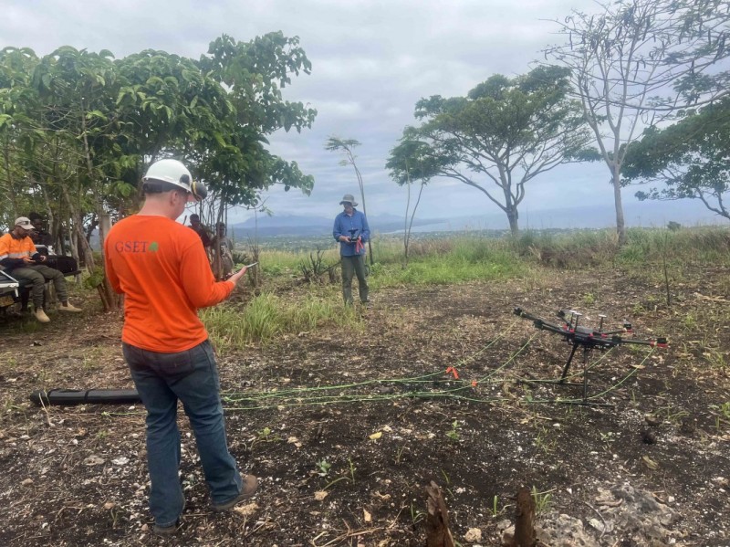
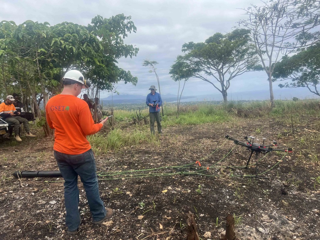
The Binghamton University researchers flew drones equipped with LIDAR and magnetometers to document the battlefield, located in a rugged landscape that makes manual surveys unfeasible. LIDAR, short for light detection and ranging, uses a pulsed laser to generate three-dimensional images of the topography — penetrating even heavy tree cover. The magnetometer measured the amount of metal on the ground, an additional layer of evidence for the battlefield.
The International Archaeological Research Institute (IARI) initially contacted Lipo about the research opportunity based on his use of drones to conduct research on Easter Island. Conversations with DPAA began prior to the coronavirus pandemic, which delayed the work.
Pingel, a LIDAR specialist, joined the faculty at Binghamton University earlier this year; the drone pilot during the mission, he was responsible for setup, data analysis and developing visualizations. Mulhern, who learned about the opportunity from Associate Professor of Earth Sciences Alex Nikulin, was in charge of collecting data from the magnetometer, although he also helped set up the LIDAR and kept detailed notes of everything the team did during the research expedition.
While Mulhern has traveled quite a bit through the years, this was the first time he’s been outside of North America.
“This is very far away, the other side of the world; the time change was 15 hours ahead,” he reflected. “The terrain was like nothing I’ve seen before.”
One of the least-visited places on Earth, the Solomon Islands were a critical spot in the Second World War. By August 1942, the Japanese had already landed on Guadalcanal, and the U.S. Marines were building Henderson Field, which became the primary airbase for the United States’ Pacific activities.
In the field
During the 10-day project, the team worked on an area known as Gifu Ridge, one of the sites where the Marines battled the Japanese.
“It’s an amazing landscape. You’re on top of this ridge that’s overlooking the sea along the coast where Henderson Field is today, which is the Honiara International Airport,” Lipo said. “You can see what the Americans were concerned about because it has command over this large area that they were trying to protect.”
The vista is an eclectic mix of old and new: the modern airport, a nearby village built in the 1970s and people engaged in traditional swidden agriculture, on top of an intact World War II battlefield. The area field isn’t well-documented; only a single aerial photograph exists from the war.
For Pingel, the greatest challenge was creating the flight plan the drone needed to fly autonomously above the ground. That’s an easy task on level terrain; for a landscape marked by high, forested ridges, not so much. The team used a camera feed to monitor the drone’s progress as it went, making sure that it stayed on track.
“The first flight was a nail-biter, but everything went fine,” he said.
The next challenge: the magnetometer, which must pass much lower to the ground than the LIDAR unit. The team used the data they gathered during the first few days to build a high-resolution model of the ground surface, which they fed into the flight planner — a first for Pingel.
“That’s the kind of innovation that really only happens when you’re on-site, facing new challenges and doing new things,” he said.
Mulhern plans to continue working with the data he collected during the trip. He appreciated the interdisciplinary nature of the project, which brought together geologists, geographers, historians and archaeologists for a shared goal.
“This has really opened my mind to the possibilities of drone-based geophysics,” Mulhern said.
The trip was hopefully the first of others in partnership with the DPAA. The team hopes to conduct similar research on Guam’s Blue Ridge in the future, as well as return to the Solomons.
“In archaeology, you tend to do a lot of intellectual things, such as studying a past landscape and its relationship to pre-contact history,” Lipo said. “In this case, you’re dealing with named individuals with ties to living families. It’s a level of detail and story that you rarely get in archaeology.”