The GIS and Remote Sensing Core Facility in conjunction with the Geography Department are pleased to announce that our 10th annual GIS Day was as success!
*It was held on November 21st in the Old Champlain Atrium *
We hosted a variety of Faculty, Student, and Alumni Lightning Talks
- Dr. Joe Panzik, Earth Sciences/FRI, Assistant Research Professor
“FRI and Undergraduate Student Training in GIS” - Alana McKeon, Geography, Graduate Student
“Improving 3D Urban Thermal Models from UAV Imagery Using Emissivity Correction and Multispectral-Based Material Classification” - Dr. Tom Pingel, Geography, Associate Professor and Chair and Gianna Mango, Undergrad
Student
“3D Printing the Binghamton University Campus” - Stephanie Brewer, Chief Planner, Broome County Department of Planning & Economic Development
“GIS as an Essential Tool for County Planning” - Zach Staff, New York/Mid-Atlantic Regional Aviation Director, McFarland Johnson, Inc
“GIS + Airports: Making Planning More ‘Dynamic’” - Md. Awual Baksh, Graduate Student
“My Journey to Becoming a Certified GIS Professional (GISP)” - Dr. Melissa Haller, Digital and Data Studies, Instructor
"Eviction Mapping with DIDA 426 and Binghamton’s Fair Housing Advisory Board” - Dr. Cordelia Martin-Ikpe, Africana Studies, Assistant Professor
"Spatial Data Analysis and Visualization in RStudio" - Dr. Yingxue Zhang, School of Computing, Assistant Professor
“Modeling Spatial Dependencies in Traffic Prediction with AI Techniques”
Student Poster and Map competition winners!
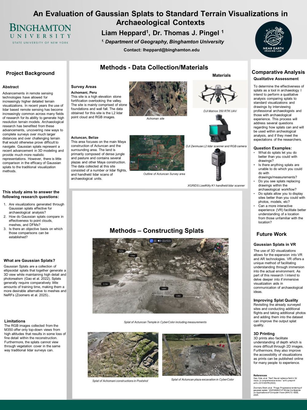
- First Place Graduate Poster: Liam Heppard
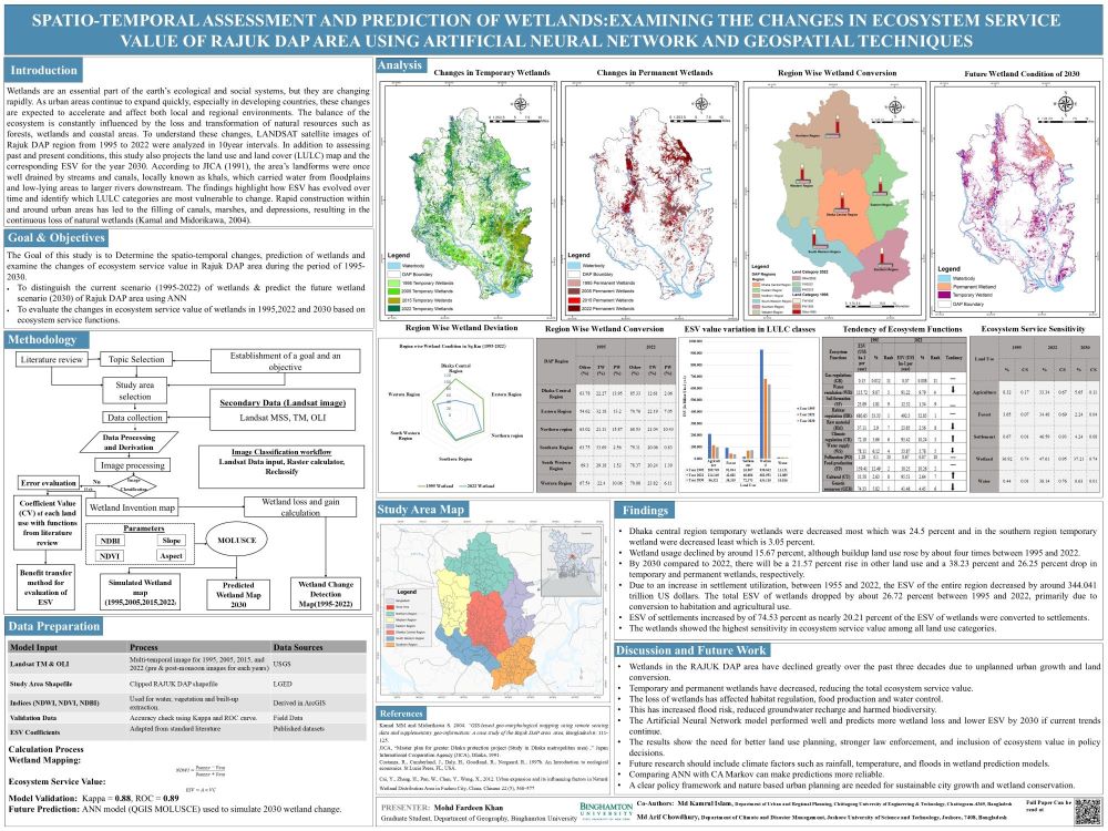
- Second Place Graduate Poster: Md. Fardeen Khan
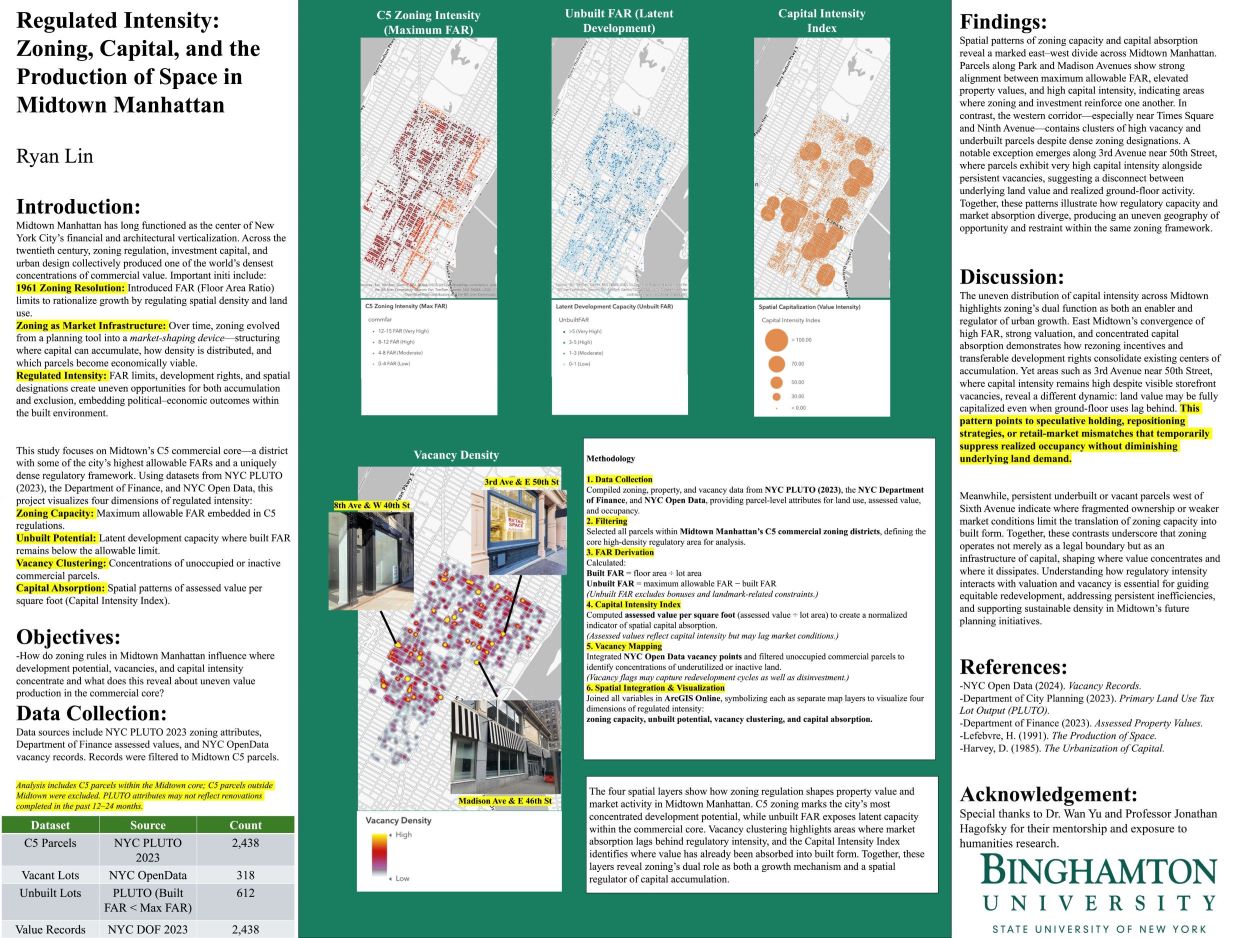
- First Place Undergraduate Poster: Ryan Lin
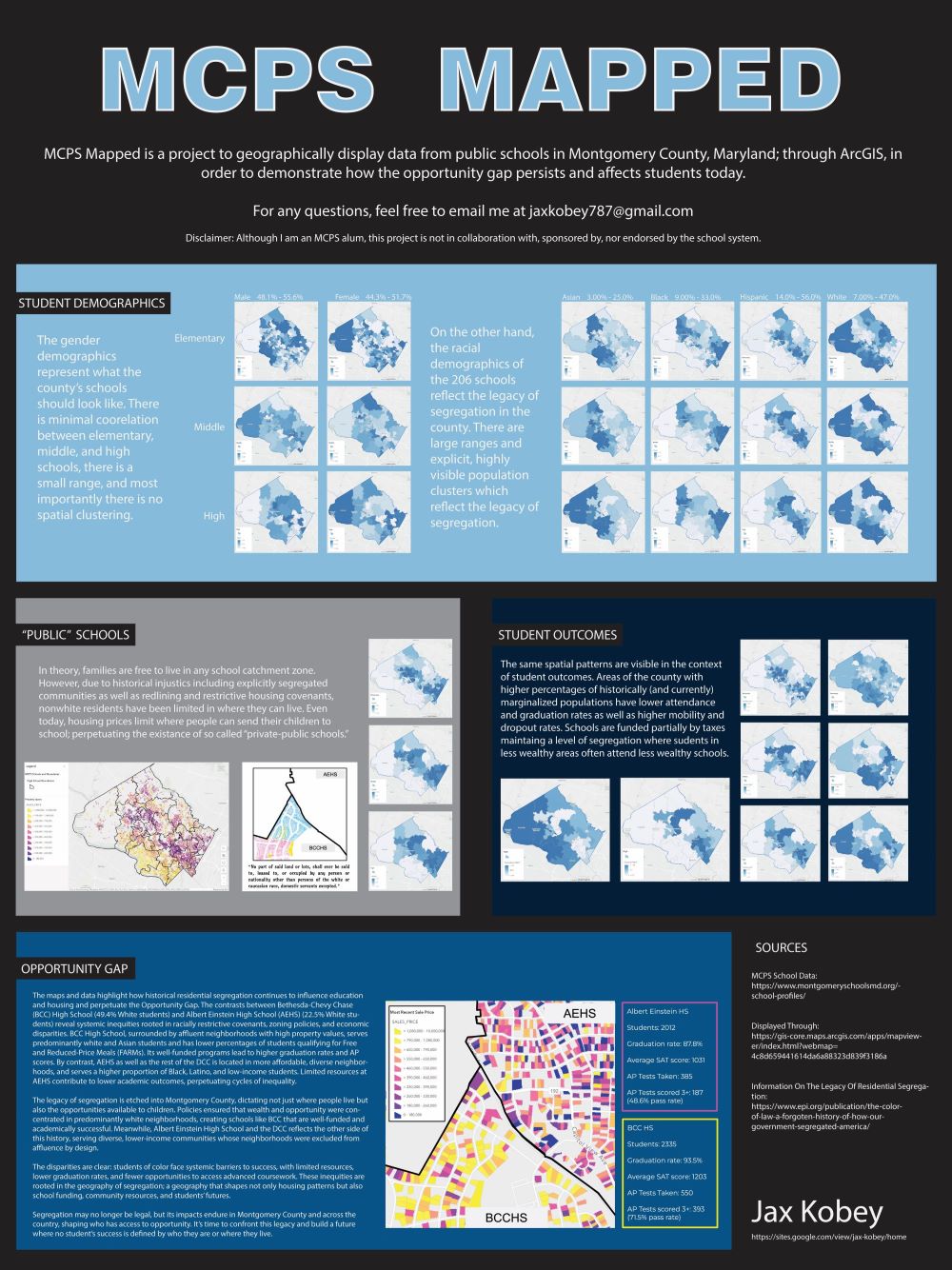
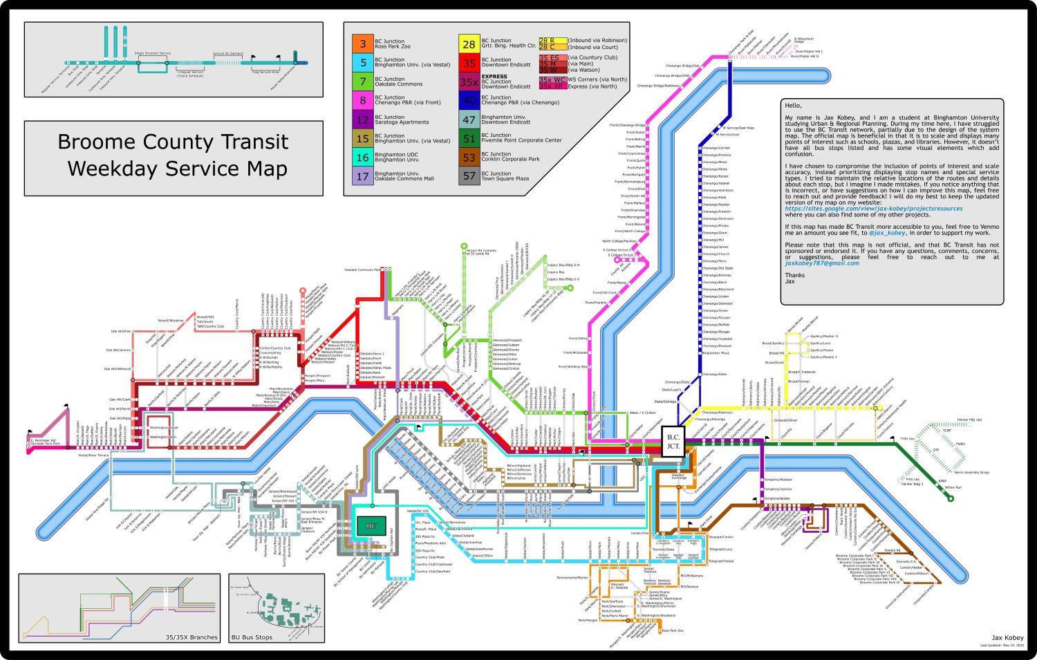
- Second Place Undergraduate Poster: Jax Kobey
- First Place Map: Jax Kobey
- Second Place Map and People's Choice Award Map: Md. Fardeen Khan
-
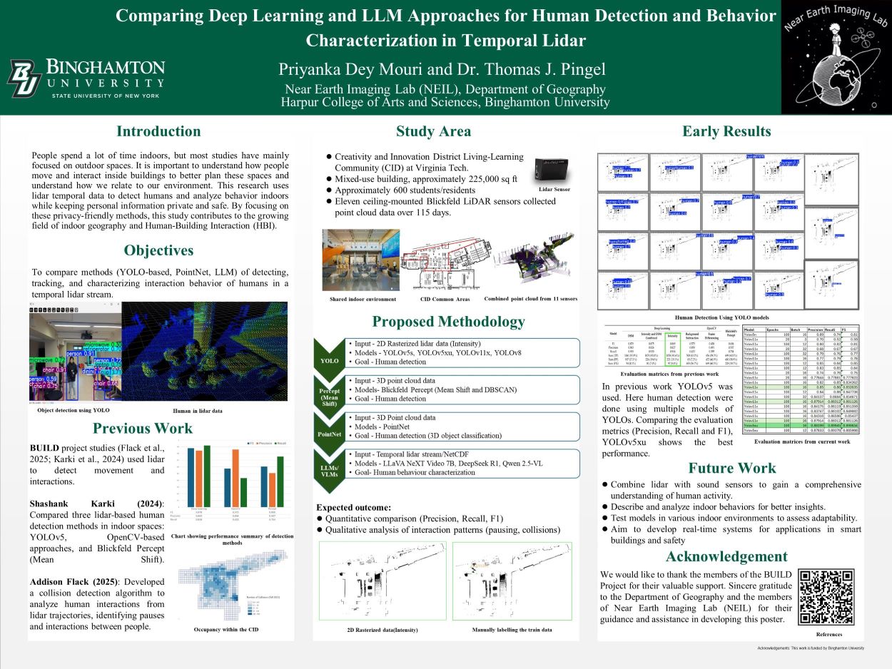
People's Choice Poster: Priyanka Dey Mouri
Welcome Video from ESRI President Jack Dangermond
Archived information from past events
What is GIS Day?
GIS Day is a day dedicated to showing, teaching, and inspiring other with the use of GIS technology. This event aims to spread enthusiasm and help people learn how to use GIS for themselves—in their work, in their classes, where they volunteer, or even for their hobbies and interests.
GIS Day was founded 25 years ago by ESRI President and Co-Founder Jack Dangermond. Dangermond credits Ralph Nader with being the person who inspired the creation of GIS Day. He considered the event a good initiative for people to learn about geography and the many uses of GIS. He wanted GIS Day to be a grassroots effort and open to everyone to participate.
Other Useful Content
GIS Day 2023 Summary Video by Dr. Joseph Kerski
Contact Information
Event Organizers
Kevin Heard
GIS Core Facility Associate Director
Email: giscore@binghamton.edu
Phone: 607-777-3536
Office: OJ-133
Tom Pingel
Geography Department Chair and
GIS Core Facility Co-Director
Email: tpingel@binghamton.edu
Phone: 607-777-3069
Adam Mathews
Geography Department Graduate Director and
GIS Core Facility Co-Director
Email: adam.mathews@binghamton.edu
Phone: 607-777-2615
Skye Naslund
Geography Department and
GIS Core Facility Affiliate
Email: snaslund@binghamton.edu
Phone: 607-777-6767
Melissa Haller
Digital and Data Studies Undergraduate Director and
GIS Core Facility Affiliate
Email: mhaller@binghamton.edu
Phone: 607-777-2628