All FRI students present their research posters at campus events. Each cohort presents two posters, the first is a pre-proposal developed in the fall first-year Research Methods Seminar. The second poster represents results from the research proposed in the spring first-year course and then conducted in the fall second-year course. These posters are presented at a public session at the annual FRI Research Day in December. At that event, each student team has an opportunity to talk with other faculty and students about their research results.
Environmental Visualization with Drones Research Themes
- Harmful algal blooms (HABs) detection, monitoring, and prediction relying on UAV-based hyperspectral imaging (HSI) of Seneca Lake.
- Death of eastern hemlock resulting in increased erosion and sedimentation rates, which increases water temperature and introduces large amounts of nitrogen and phosphorous into lakes. Use of wide-area hyperspectral imaging to detect early signs of stress in eastern hemlock forests to help stakeholders effectively manage and mitigate this environmental challenge.
- Development of UAV-based sensors (magnetic, LiDAR, methane) to detect abandoned uncapped oil and gas wells that are currently emitting methane, which provides detection of emitting wells as first step in complex effort to mitigate anthropogenic methane emissionsm which are 25 times more potent than carbon dioxide as a greenhouse gas.
- Tick and lyme disease modeling in collaboration with the Tick-bourne Diseases Center where data from remote sensing, tick dragging, rodent trapping, and DNA are used to create a model of tick and tick-bourne disease risk and prevalence.
- Landmine and unexploded ordnance detection and remediation with magnetic, electromagnetic, and thermal remote sensing methodologies, which are safer and more time and cost efficient than previous terrestrial methods.
- Induced seismicity probabilistic modeling study harnessing “big data” to determine and model which variables most influence induced seismicity and predict where earthquakes will occur.
- Genocide and mass atrocity prevention (GMAP) focused on forensic remote sensing with an active forensics controlled test site with 6 buried pig cadavers at different depths and with various sedimentary conditions.
- Archaeological remote sensing and environmental archaeology (geoarchaeology, biological markers like coprostanols) at Poverty Point World Heritage Site (Louisiana), Queen Esther’s Village Archaeological Conservancy Site (Pennsylvania), Nantahala National Forest (North Carolina), San Luis de Talimali (Florida), Chaco Canyon and Cibola National Forest sites (New Mexico), Easter Island (Chile).
Cohort 11 2024-25 in Fall 2024, as first-year students (pre-proposal stage)
- Anthropogenic causes of sinkholes
- Monitoring trail effects on surrounding vegetation
- Natural biofiltration and its effect on water quality
- Previous training and accessibility in geoscience
- Understanding environmental changes through Antarctic sediments
Cohort 10 2023-24 in Fall 2024, as second-year students (research results)
- Biological soil crusts (BSCs) in the wetlands of Binghamton, NY
- Hemlock wooly adelgid (HWA) and its effect on the relative dielectric permittivity in hemlock trees
- Identification of orphaned methane wells in Salt Springs State Park, PA
- Subsurface cemetery mapping with ground penetrating rada
Cohort 10 2023-24 in Fall 2023, as first-year students (pre-proposal stage)
- Analyzing the spread of “forever chemicals” (PFAS) from U.S. groundwater contamination sites
- Cemetery mapping usage in marginalized vs. non-marginalized communities
- HWA effects on water retention in Eastern hemlock trees
- Remote oil spill detection via satellite microwave sensing
- Water retention and infiltration based on soil crusts
Cohort 9 2022-23 in Fall 2023, as second-year students (research results)
- Assessment of UAV-mounted GPR for UXO detection
- Comparing UAV detection of UXO via magnetometry
- Importance of atmospheric correction in UAV detection of harmful algal blooms
- Non-invasively mapping mycelium using geophysical methods
- Seasonal variation in detecting submarine groundwater discharge using drone-mounted thermal imaging
Cohort 9 2022-23 in Fall 2022, as first-year students (pre-proposal stage)
- Advantages of LiDAR for ladmine detection
- Hemlock Woolly Adelgid - future projections for animal species survival as global warming prompts dispersion
- How do environmental factors affect the toxins produced by HABs
- UXO remediation: what is the best way to reduce UXO casualties?
- Viability of coastal seeps as a means of combating droughts on Rapa Nui
Cohort 8 2021-22 in Fall 2022, as second-year students (research results)
- Hyperspectral imaging can be used to detect and monitor harmful algal blooms
- Testing the combination of imidicloprid and forest thinning treatments to reduce the spread of HWA
- Utilizing hyperspectral imaging & LiDAR to detect explosive remnants of war
- Utilizing thermal imaging to detect UXOs: field trial results
Cohort 8 2021-22 in Fall 2021, as first-year students (pre-proposal stage)
- Detecting imporovised explosives (IEDs) with unpilotted aerial systems (UAS)
- Freshwater tracking on Easter Island
- How does climate change impact HABs and its effect on the environment
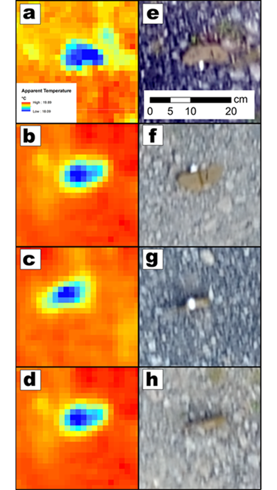
- Machine learning to improve detection of PFM-1 landmines with thermal imaging
- The effect of sunlight and temperature on hemlock woolly adelgid (HWA)
Cohort 7 2020-21 in Fall 2021, as second-year students (research results)
- The non target effects of entomopathogenic fungi on Sasajiscymnus tsuage: A pilot study
- Effective spatial sensing of abandoned oil wells
- Remote detection of landmines
- UAV-based monitoring to track deer overpopulation in upstate New York
- Using hyperspectral imaging to detect harmful algal blooms
Cohort 7 2020-21 in Fall 2020, as first-year students (pre-proposal stage)
- A comparative study on the efficacy of combinations of specialist adelgid predator beetles for treatment of HWA
- Methane mapping with remote sensing in New York State
- Predicting Lyme disease outbreaks using remote sensing technology
- The detection of UXOs using remote sensing and drones
- Using remote sensing to detect lipid content within harmful algal blooms
Cohort 6 2019-20 in Fall 2020, as second-year students (research results)
- Creating a geodatabase to prevent Lyme disease
- Geospatial technology to track genocidal activity in Myanmar
- Remote sensing of harmful algal blooms
- Remote sensing to detect anti-tank mines
- The effect of imidacloprid on hemlock woolly adelgid populations
Cohort 6 2019-20 in Fall 2019, as first-year students (pre-proposal stage)
- Creating a Geodatabase to Prevent Lyme Disease
- Geospatial Technology and Sex Trafficking
- Harmful Algal Blooms
- Unexploded Ordnance Detection Using Remote Sensing
- Using Remote Sensing to Determine the Effect of Chemical Treatment on Hemlock Tree Reflectance
Cohort 5 2018-19 in Fall 2019, as second-year students (research results)
- Predictive modeling of disease-carrying tick density using remote sensing
- Spectral Detection of Stress in the Eastern Hemlock by Woolly Adelgid
- The Use of Spectral Remote Sensing to Detect, Monitor and Predict Harmful Algal Bloom Location and Intensity
- Using Existing Data Sets and Statistical Analysis to Predict the Likelihood of Mass Shootings in Florida
Cohort 5 2018-19 in Fall 2018, as first-year students (pre-proposal stage)
- Detecting Stress in the Eastern Hemlock by the Woolly Adelgid
- Predictive modeling of disease-carrying tick density using drone based imagery
- The Use of Hyperspectral Remote Sensing in the Detection, Monitoring, and Prediction of Harmful Algal Blooms
- The Detection of Unexploded BM-21 Grad 122 mm Missiles
- Using Modern Technology to Detect and Prevent Genocide and Mass Atrocities
Cohort 4 2017-18 in Fall 2018, as second-year students (research results)
- A Statistical Approach to Modeling Induced Seismicity in Oklahoma Using Multiple Linear Regression
- Comparison of Remote Sensing Techniques in the Search for Unmarked Buried Bodies
- Deploying a UAV-Based System to Identify MEthane-Emitting Oil and Gas Wells
- Remote Sensing and World Systems Theory at Queen Esthers Site
- Using Remote Sensing to Detect Tree Distress Due to Woolly Adelgid Infestation
Cohort 4 2017-18 in Fall 2017, as first-year students (pre-proposal stage)
- Using Remote Sensing to Detect Tree Distress Due to Wooly Adelgid Infestation
- Increase in Earthquakes as a Result of Wastewater Injection
- Comparison of Remote Sensing Techniques in the Search for Unmarked Buried Bodies
- Vegetation's Impact on Poverty in the Binghamton Area
- Shovel Testing vs. Remote Sensing at Queen Esther's Site
Cohort 3 2016-17 in Fall 2017, as second-year students (research results)
- Detecting PFM-1 Mines Using Drone-based Thermal Imaging
- Detecting Pig Cadaver Clandestine Graves
Cohort 3 2016-17 in Fall 2016, as first-year students (pre-proposal stage)
- Pilot study to detect landmines with UAV mounted thermal infrared
- Long term forensic study to detect pig cadavers with geophysical methods