Phase 1: Archaeological Survey
The site was discovered during a Phase 1 survey of the area conducted in 1997. The goal of a Phase 1 survey is to determine if there are cultural resources (archaeological sites, standing historic buildings, important landscapes, etc.) within a project area, such as the proposed I-86 corridor. Archaeologists from the Public Archaeology Facility crews identified several cultural resource properties during survey, including the historic Baldwin site. Crews recovered 204 historic artifacts from 15 Shovel Test Pits (STPs) excavated within the front and side yards of the house. These artifacts included a minimum of 24 ceramic and glass vessels dating to the 19th and early 20th centuries, as well as animal bones, architectural debris, and other household objects. The artifact assemblage suggested that the site had the potential to be eligible for the National Register of Historic Places. However, additional investigations were needed to confirm the site's significance. A Phase 2 site examination was recommended to collect a larger sample artifacts from the site and identify features that would contribute to arguments for significance.
Phase 2: Site Examination
The site examination excavation was authorized and conducted in 2002. This phase of investigation consisted of the excavation of 16 units measuring 1 x 1 m, as well as six additional STPs at closer intervals, such as 5 m (16 ft), mostly adjacent to the road's shoulder. The archaeological team discovered that the site included not only a dense and diverse artifact assemblage, but two cultural features. One feature was a segment of fieldstone wall (Feature 1) and the other was a rich, organic midden associated with that wall. These features were initially interpreted as the remains of a summer kitchen. Their preservation indicated that cultural deposits would have a high degree of integrity across much of the site. In other words, the site contained features that were generally intact beneath the surface of the ground and artifacts in good contexts that were associated with the Baldwins, Lowmans, and other occupants of the property.
The results of the site examination demonstrated that the site had a high data potential. When combined with the historic significance of the house's age, its context (association with the Baldwins and Lowmans), and its possible connection to early interactions with Native Americans, the evidence supported an argument that the site was eligible for the National Register. PAF recommended that the site be avoided by the I-86 project impacts, or that impacts to the site be mitigated by a Phase 3 data recovery.
Phase 3: Data Recovery
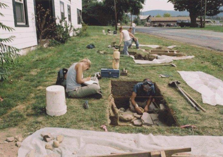
The purpose of a Phase 3 Data Recovery is to preserve the information from a site if it is not possible to preserve the site in place. The data recovery excavations took place in 2005. This phase of work included the excavation of 34 units, for a total of 50 units when added to the Phase 2 project. The majority of units were concentrated in the front yard of the house, between its driveway and that of a neighboring home. This area was targeted for data recovery due to the high density of artifacts but also to investigate the organic midden and "kitchen" wall identified off the eastern corner of the house. A second fieldstone wall (Feature 2) was also discovered during this phase.
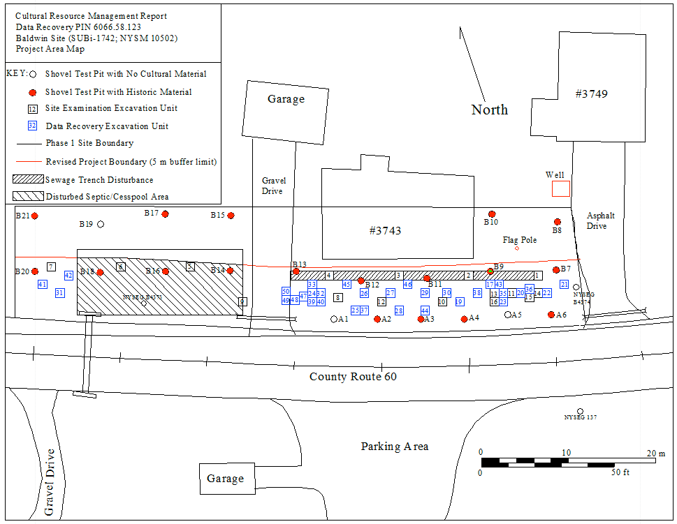
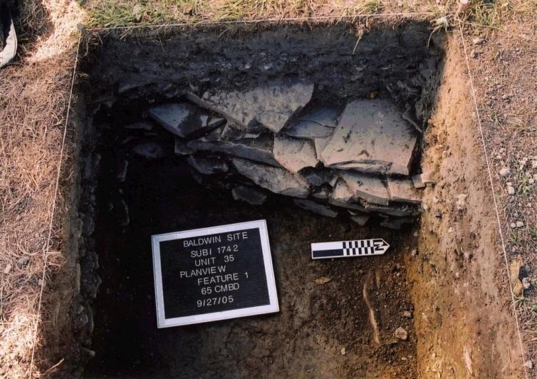
Feature 1 was located off the eastern corner of the original, 18th century wing of the house. The associated organic midden included a high amount of animal bone and food-related artifacts (e.g., ceramic dish fragments), which led to the initial interpretation as a summer kitchen for the original structure. The dry-stacked stone wall was oriented along a roughly northeast-southwest axis and at an angle to the house. The wall presumably extended past the corner of the house, but was intersected by the sewage trench and the side yard was outside the project boundaries.
The wall measured approximately 35 cm (14 in) thick, and the presence of midden on the east and west sides convinced archaeological crews that this was not an architectural wall for a summer kitchen or other piece of architecture. Mean dates calculated from diagnostic ceramic and glass vessels indicated that the wall and midden were primarily used in the first quarter of the 19th century, particularly during the occupancy of Mary Goodwin (1824-1834). Artifacts derived from the soil covering the wall and midden date to the Lowman period, indicating that the feature was no longer in use during the mid- to late 19th century.
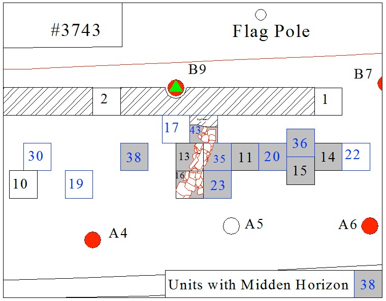
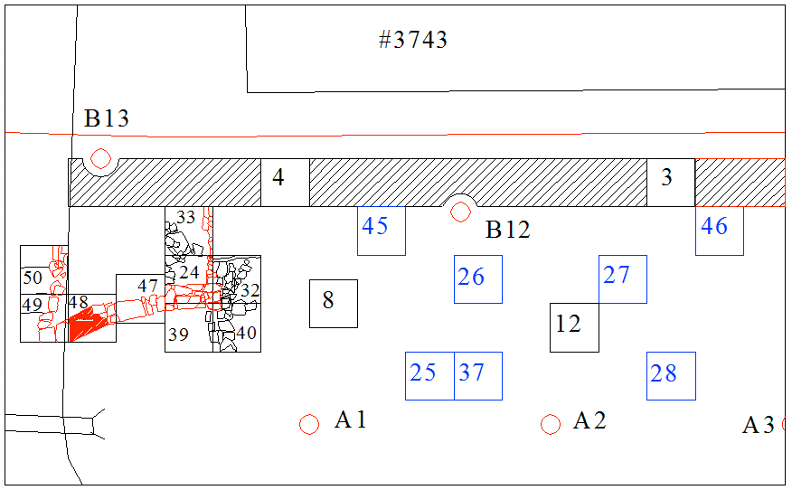
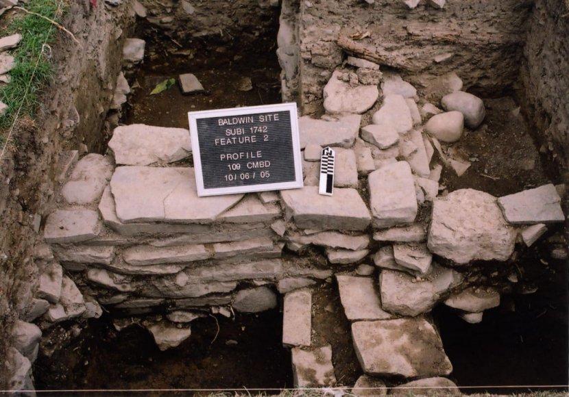
Feature 2 consisted of a stone foundation (mapped in red) as well as rock debris (mapped in black) from the destruction of the foundation's super-structure. The foundation was oriented parallel to the western façade of the Federal-style structure, suggesting that it was an outbuilding built in conjunction with, or after, this addition. Again, the pipe trench and project boundaries stymied excavator's abilities to determine the northern extent of the feature and its exact spatial relationship to the house. However, the intact wall segments showed that the outbuilding's southern wall was approximately 3.75 m (12 ft) long. No builder's trench was observed along the outer side of the walls, as the soil stratigraphy was consistent with that of the general yard. The exception was the western two units, which were excavated into the gravel driveway to reveal intact portions of the wall beneath. The interior soils were mottled backfill likely deposited when the structure was demolished. Interestingly, the artifact assemblage recovered from inside the feature was more dense and diverse than that of the area immediately outside the walls. Mean vessel dates indicate that the structure was destroyed during the Lowman family's ownership, possibly during the occupancy of Lyman Lowman.
