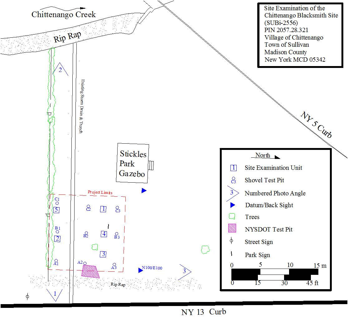
The Phase 1 survey consisted of nine shovel test pits (STPs) placed at 5 m (16.4 ft) intervals across the project area. A typical survey in the location of a Map Documented Structure (MDS) like the blacksmith shop would have used a 7.5 m (25 ft) testing interval, but the archaeological team elected to use the shorter test pit interval due to the small size of the project area. Archaeological deposits were encountered within all nine STPs.
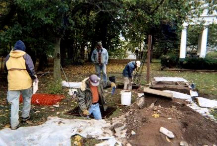
The Phase 2 site examination used five 1 x 1 m (3.3 x 3.3 ft) units excavated in 5 cm (2 in) levels within discrete soil types (Figure 5). The stratigraphy and artifact contents of each unit varied across the site and included structural and functional features of the blacksmith shop. While the excavations were confined to the project area boundaries, the results of the site examination suggested that archaeological deposits likely extend north, south, and west of the project area. The site did not extend to the east, where previous roadwork for NY 13 had occurred and where an earlier survey did not encounter significant archaeological deposits (LoRusso 1995).
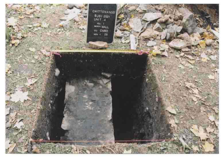
Of particular interest to the project was the identification of features associated with the blacksmith shop. Figure 7 shows a segment of the western foundation wall (Feature 1) which was encountered in Unit 4. This unit was placed in this location after an STP (B3) was obstructed by what appeared to be a foundation. The shop interior was to the right of this wall, and the archaeological team encountered a cluster of brick and charcoal debris buried beneath the rubble fill associated with the destruction of the shop building. This deposit (Feature 2) was interpreted as a brick forge which was apparently dismantled and buried while the shop was still in use. Unit 3 was located east of Unit 4 inside the shop's interior, and included a feature unique to blacksmith shop sites (Seib 2011): a deposit of scale. Scale is the oxidized impurities in metal which are released when the super-heated metal is struck with a hammer. We see these impurities fly off the metal as sparks, but when they cool they resemble tiny black flakes. Scale is magnetic and can be identified in the field with a simple magnet. A deposit of scale indicates the location of the shop's anvil. Figure 8 represents the stratigraphy of Unit 3, which illustrates the scale lens as lying on the shop floor, as well as the rubble fill from the building's demolition.
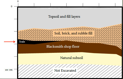
Unit 3 soil profile showing layers of topsoil, rubble fill, the scale lens, the blacksmith shop floor, and natural subsoil.