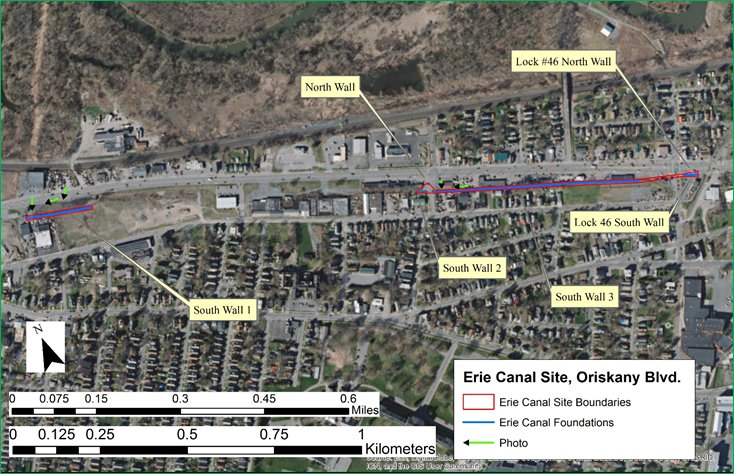
Archaeological monitoring along SR 5A (Oriskany Boulevard), side streets, and outfall lines identified one portion of the demolished north wall of the Erie Canal, possible remains of an expanded Erie Canal north wall, and remains of southern wall of the northern channel of Lock 46 (Erie Canal Site [SUBi-3246]). The identification of features related to the Erie Canal (listed on the National Register), suggests that remains of the lower portions of the canal wall and Lock 46 may remain intact within and along Oriskany Boulevard, despite the construction of the roadway and the buried utilities that are located underneath the roadways and areas adjacent to the roadways.
Archaeologists also identified the Barnes Avenue 1 (SUBi-3248) and Barnes Avenue 2 (SUBi-3249) Sites, and the Durr Site (SUBi-3250). Numerous historic utilities and historic debris were encountered along the length of Oriskany Boulevard. These remains stand as mute testimony to this transportation corridor’s transformation from a lonely strip of land at the edge of the Mohawk River floodplain to the developed, bustling four lane road that it is today.